GPS/GIS & Mapping Services
what is GPS/GIS & Mapping?
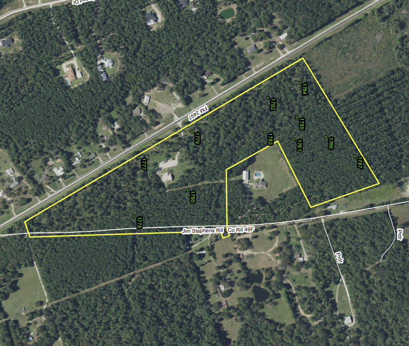
Acorn provides GPS and GIS (Geographic Information System) services to give landowners an accurate, detailed picture of their property. Using advanced mapping and positioning technology, we can locate boundaries, mark key features, and create customized maps. These maps may highlight stands of timber, streamside buffers, roads, or wildlife areas—depending on the landowner’s goals.
the benefit to landowners:
Clear, reliable data supports better decision-making across all aspects of land management: landowners can plan timber harvests, confirm property boundaries, identify sensitive areas for wildlife, and even design improvements for recreation. Whether the focus is timber production, habitat enhancement, or overall stewardship, these services provide a practical foundation for long-term success.
Acorn is currently a leader among forestry companies in the southeast specializing in prescribed burning, reforestation, and timberland management. Acorn was started back in 1997 and incorporated in 1999 in Huntsville, TX.